
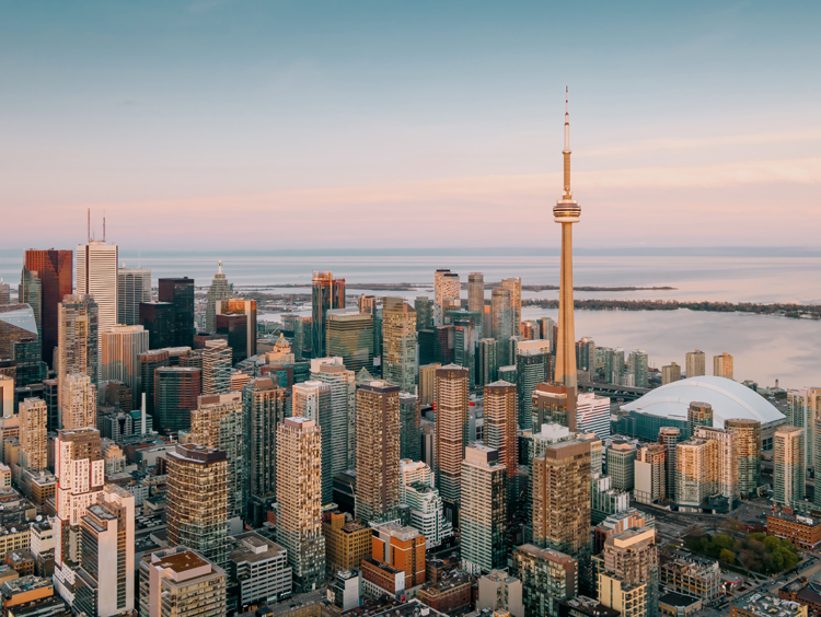
Toronto, Ontario
A city of
neighbourhoods.
Nearly three million people across 631 square kilometres, and almost nobody says they live in Toronto — they say Leslieville, or Roncesvalles, or Leaside.
One city, and
a hundred and forty villages.
Toronto sits on the northwest shore of Lake Ontario at the centre of the Golden Horseshoe. Three ravine systems — the Humber, the Don and Highland Creek — cut through it, which is why so much of the green space runs in valleys rather than squares.
Toronto — 631 km² on the lake
0
Residents
(2021 Census)
0 km²
Land Area
0
Incorporated
0
Median Age
On the Lake
More than 40 km of shoreline from Marie Curtis Park to Bluffer's Park, linked by the Martin Goodman Trail, with the car-free Islands a short ferry away.
Everything Runs to Union
Three TTC subway lines, seven GO rail corridors and the 25-minute UP Express to Pearson all meet at Union Station.
The Ravines
Roughly 17% of the city is ravine and valley land — the Don trails, Humber Valley and 161-hectare High Park among them.
Main Streets, Not Malls
Queen West, Ossington, College, the Danforth and the Distillery District each carry their own identity.
Three Universities
The University of Toronto, Toronto Metropolitan and York, alongside long-established public high schools across the city.
A Full Calendar
TIFF each September, Caribbean Carnival at Exhibition Place, Nuit Blanche, and the CNE, running since 1879.
Population, area and median age from the 2021 Census of Population (Statistics Canada). Statistics Canada estimated roughly 3.1 million residents as of July 2023.
What People Love
Why people move here
and then stay.
Ask ten Torontonians why they chose their neighbourhood and you'll get roughly these six answers.
Twenty-two neighbourhoods,
and what each one is like.
Toronto is not one market. Choose a neighbourhood to see the schools, parks, transit and housing mix that define it.
East End · Lakefront
Boardwalk at the end of the street
East-end Toronto along the lake, with a boardwalk, a wide sand beach and a Queen Street village behind it. Detached Edwardians and semis, plus boutique low-rise condo.
Schools
Balmy Beach Community School, Malvern Collegiate Institute
Parks & Green Space
Kew Gardens, Woodbine Beach Park
Getting Around
501 Queen streetcar; Main Street (Line 2) and Woodbine GO nearby
Walkability
Very walkable
Housing
Detached Edwardians, semis, boutique low-rise condos
East End · Queen East
The east end's restaurant strip
Queen Street East between the Don and Coxwell, rebuilt over twenty years into one of the city's better food strips. Victorian semis and converted lofts.
Schools
Duke of Connaught Junior and Senior PS, Leslieville Junior PS
Parks & Green Space
Greenwood Park, Jonathan Ashbridge Park
Getting Around
501 and 502 streetcars; DVP via Eastern Ave
Walkability
Very walkable
Housing
Victorian semis, row houses, converted lofts
East End · Don Valley edge
Park views and Victorian semis
On the east bank of the Don, with Riverdale Park East looking straight back at the skyline. Semi-detached and detached Victorians on deep lots.
Schools
Frankland Community School, Riverdale Collegiate Institute
Parks & Green Space
Riverdale Park East, Withrow Park
Getting Around
Broadview (Line 2); DVP at Bloor
Walkability
Very walkable
Housing
Semi-detached and detached Victorians
East End · Danforth Ave
Greektown and the subway
Along Danforth Avenue with the Line 2 subway underneath it. Brick semis and duplexes on the side streets, restaurants on the strip.
Schools
Jackman Avenue Junior PS, Riverdale CI
Parks & Green Space
Withrow Park, Monarch Park
Getting Around
Chester and Pape (Line 2)
Walkability
Very walkable
Housing
Brick semis, duplexes, walk-up apartments
Downtown East · Heritage
One of the largest Victorian districts
A heritage conservation district east of downtown, with one of the largest intact areas of Victorian housing in North America and a working farm in the middle of it.
Schools
Rose Avenue Junior PS, Lord Dufferin Junior and Senior PS
Parks & Green Space
Riverdale Farm, Allan Gardens
Getting Around
Castle Frank (Line 2); 506 Carlton streetcar
Walkability
Very walkable
Housing
Restored Victorian detached and semis
Central · Bloor corridor
Between two subway lines
West of Yorkville along Bloor, wrapped around the University of Toronto. Victorian mansions, converted multiplexes and student rental.
Schools
Huron Street Junior PS, Jesse Ketchum Junior and Senior PS
Parks & Green Space
Ramsden Park, Jean Sibelius Square
Getting Around
Spadina, Bathurst and St. George (Lines 1 and 2)
Walkability
Very walkable
Housing
Victorian mansions, converted multiplexes, student rentals
Central · Bloor-Yonge
The city's luxury address
Between Bloor and Davenport, where the luxury retail strip meets a pocket of surviving heritage row houses. Almost entirely condo above street level.
Schools
Jesse Ketchum Junior and Senior PS, Jarvis Collegiate Institute
Parks & Green Space
Ramsden Park, Village of Yorkville Park
Getting Around
Bay and Bloor-Yonge stations
Walkability
Very walkable
Housing
Luxury condo towers and heritage row houses
Central-west · College St
College Street, and Christie Pits
Along College west of Bathurst, with Christie Pits at the top and Bickford Park beside it. Victorian semis and row houses throughout.
Schools
Montrose Junior PS, Central Technical School
Parks & Green Space
Christie Pits Park, Bickford Park
Getting Around
506 College streetcar; Christie (Line 2)
Walkability
Very walkable
Housing
Victorian semis and row houses
West End · Queen West
The park everyone meets at
West Queen West around Trinity Bellwoods Park. Victorian rows and hard-loft conversions, with the city's densest run of galleries and bars.
Schools
Givins/Shaw Junior PS, Ossington/Old Orchard Junior PS
Parks & Green Space
Trinity Bellwoods Park
Getting Around
501 Queen and 505 Dundas streetcars
Walkability
Very walkable
Housing
Victorian rows, semis, hard-loft conversions
West End · Parkside
High Park at one end, the lake at the other
Roncesvalles Avenue between Bloor and the Queensway, with High Park on one side and the waterfront below. Edwardian semis and detached.
Schools
Fern Avenue Junior and Senior PS, Howard Junior PS
Parks & Green Space
High Park, Sorauren Avenue Park
Getting Around
504 King streetcar; Dundas West subway plus Bloor GO and UP Express
Walkability
Very walkable
Housing
Edwardian semis and detached, some triplexes
West End · Dundas West
A former railway town
Around Dundas Street West and Keele, dry until 1998 and redeveloped hard since. Detached Edwardians with new mid-rise along the strip.
Schools
Keele Street PS, Humberside Collegiate Institute
Parks & Green Space
High Park, Baird Park
Getting Around
Keele and High Park (Line 2)
Walkability
Very walkable
Housing
Detached Edwardians, low-rise apartments, new mid-rise
West End · Humber
A main street with a subway under it
Bloor Street west of High Park, with Swansea below it running down to the Humber. Detached brick two-storeys and Tudors.
Schools
Swansea Junior and Senior PS, Runnymede Junior and Senior PS
Parks & Green Space
High Park, Rennie Park
Getting Around
Runnymede and Jane (Line 2); Gardiner via South Kingsway
Walkability
Very walkable
Housing
Detached brick two-storeys and Tudors
West Etobicoke · Humber Valley
Tudor revival on big lots
Etobicoke's most established address, laid out in the 1920s along the Humber. Tudor-revival and Georgian detached on large, treed lots.
Schools
Lambton Kingsway Junior Middle School, Etobicoke Collegiate Institute
Parks & Green Space
James Gardens, Humber Valley Park
Getting Around
Royal York (Line 2); Gardiner and Hwy 427
Walkability
Somewhat walkable
Housing
Tudor-revival and Georgian detached on large lots
West · Lakefront
Condo towers beside bungalows
On the lake west of Humber Bay, where a wall of new waterfront condo sits directly beside post-war bungalow streets.
Schools
John English Junior Middle School, Lakeshore Collegiate Institute
Parks & Green Space
Humber Bay Shores Park, Mimico Waterfront Park
Getting Around
Mimico GO; 501 Lake Shore; Gardiner
Walkability
Somewhat walkable
Housing
Waterfront condo towers beside post-war bungalows
Southwest · Lakefront
The far western lakeshore
Toronto's southwestern corner at the Mississauga border, on the water. Bungalows and semis with steady townhouse infill.
Schools
Seventh Street Junior School, Lakeshore Collegiate Institute
Parks & Green Space
Marie Curtis Park, Colonel Samuel Smith Park
Getting Around
Long Branch GO; 501 Lake Shore; QEW
Walkability
Somewhat walkable
Housing
Bungalows, semis, new townhouse infill
Midtown · Central
Midtown's established address
Between St. Clair and Eglinton west of Avenue Road. Large detached homes, a village strip on Spadina, and the Crosstown now running below Eglinton.
Schools
Forest Hill Junior and Senior PS, Forest Hill Collegiate Institute
Parks & Green Space
Cedarvale Park, Sir Winston Churchill Park
Getting Around
St. Clair West (Line 1); Eglinton Crosstown
Walkability
Somewhat walkable
Housing
Large detached homes, low-rise luxury condos
Midtown · Yonge-Eglinton
Midtown, mid-rise, mid-density
East of Yonge between Davisville and Eglinton. Semis and bungalows on the side streets, with a growing wall of condo towers on the main ones.
Schools
Maurice Cody Junior PS, North Toronto Collegiate Institute
Parks & Green Space
June Rowlands Park, Oriole Park
Getting Around
Davisville and Eglinton (Line 1); Eglinton Crosstown
Walkability
Very walkable
Housing
Semis, bungalows, and a growing wall of condo towers
North-central · Ravine
Curved streets and deep ravines
One of Toronto's first planned garden suburbs, laid out in 1907. Large Georgian and Tudor detached on curved, heavily treed streets.
Schools
Blythwood Junior PS, Lawrence Park Collegiate Institute
Parks & Green Space
Sherwood Park, Alexander Muir Memorial Gardens
Getting Around
Lawrence (Line 1); Bayview Ave to the DVP
Walkability
Somewhat walkable
Housing
Large Georgian and Tudor detached on curved, treed streets
East-central · Don Valley
Planned in 1912, still working
Between the Don Valley and Laird, laid out as a planned town in 1912. Detached brick 1930s to 50s homes with heavy custom-rebuild activity.
Schools
Bessborough Drive Elementary and Middle School, Leaside High School
Parks & Green Space
Trace Manes Park, Serena Gundy Park
Getting Around
Eglinton Crosstown (Laird); DVP minutes away
Walkability
Somewhat walkable
Housing
Detached brick 1930s-50s homes plus newer infill builds
North York · Yonge corridor
Towers on Yonge, houses behind
North York's centre along Yonge between Sheppard and Finch. Condo towers on the arterial, detached and custom rebuilds on the streets behind.
Schools
McKee PS, Earl Haig Secondary School
Parks & Green Space
Willowdale Park, Mel Lastman Square
Getting Around
North York Centre and Finch (Line 1); Hwy 401
Walkability
Very walkable
Housing
Condo towers on Yonge, detached and custom rebuilds behind
North-central · Planned
Canada's first planned suburb
Built from 1953 as Canada's first fully planned suburban community. Mid-century bungalows and split-levels, with the Shops at Don Mills at the centre.
Schools
Norman Ingram PS, Don Mills Collegiate Institute
Parks & Green Space
Edwards Gardens, Wilket Creek Park
Getting Around
Eglinton Crosstown (Science Centre); DVP and 401
Walkability
Car-dependent
Housing
Mid-century bungalows and split-levels, townhouses, new condos
East · Bluffs
Cliffs over the lake
Guildwood and the Bluffs in southeast Scarborough, where the shoreline rises into cliffs up to 90 metres. Detached mid-century homes on unusually deep lots.
Schools
Elizabeth Simcoe Junior PS, Sir Wilfrid Laurier Collegiate Institute
Parks & Green Space
Guild Park and Gardens, Bluffer's Park
Getting Around
Guildwood GO (Lakeshore East); Hwy 401
Walkability
Car-dependent
Housing
Detached mid-century homes on unusually deep lots
Neighbourhood boundaries vary between sources, and school catchments change — always confirm the catchment for a specific address with the Toronto District School Board.
Fun Facts
Nine things you probably
didn't know about Toronto.
A city that was bought for rum, burned by Americans, and cut in half by one storm.
The Toronto Purchase of 1787 took roughly 250,808 acres from the Mississaugas for money, gun flints, kettles, mirrors, hats and 96 gallons of rum. In 2010 Canada paid $145 million to settle the claim.
Simcoe founded the Town of York in 1793. It was incorporated as the City of Toronto on March 6, 1834, with William Lyon Mackenzie as its first mayor.
U.S. forces captured the town in the Battle of York and torched the parliament buildings. The burning of Washington a year later is widely described as retaliation.
A storm on April 13, 1858 cut a 500-foot channel through the sand peninsula, permanently separating the Islands. They are now the largest urban car-free community in North America.
The April 1904 fire destroyed much of the downtown core without a single death. Rebuilding under tougher codes produced the masonry warehouses that define King and Wellington.
Guinness listed it as the world's longest street at 1,896 km from 1977, conflating Yonge with all of Highway 11. The entry was dropped in 1999. The street is about 86 km.
Completed in 1975, it was the world's tallest free-standing structure until Burj Khalifa passed it during construction in 2007.
The PATH runs about 30 km, links more than 70 buildings and over 1,200 retail fronts, and held the Guinness record as the world's largest underground shopping complex.
In the March 1997 referendum more than three-quarters of voters rejected amalgamation. The province merged the six municipalities anyway on January 1, 1998.
Sources include the City of Toronto, the Canadian Encyclopedia, Heritage Toronto and Statistics Canada.
Homes in Toronto
See what's on the market
right now.
Every active listing across Toronto, updated as it comes to market. In a city this size the neighbourhood matters more than the search filter — start with a conversation.