
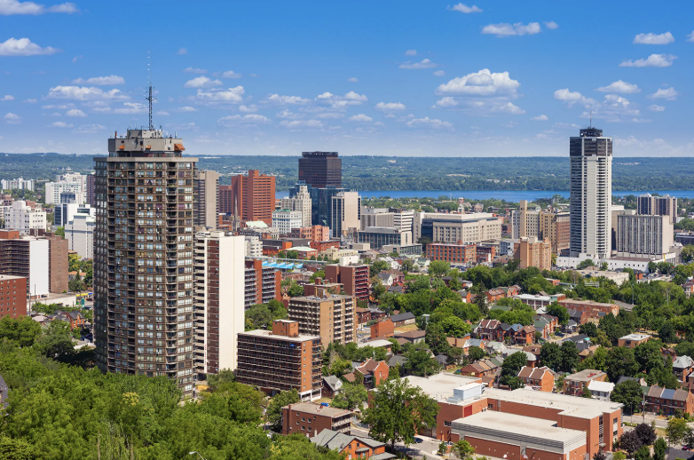
Hamilton, Ontario
A city built
on two levels.
The escarpment splits Hamilton into the lower city and the Mountain, and almost everything about living here follows from that. More than 100 waterfalls inside the city limits.
Steel town, university town,
waterfall capital.
Hamilton sits at the western end of Lake Ontario, about 68 km southwest of Toronto, where the GTA meets the Niagara Region. The Niagara Escarpment cuts diagonally across the city, splitting it into the lower city on the lake plain and the Mountain above.
Hamilton — 1,118 km² on the escarpment
0
Residents
(2021 Census)
0 km²
Land Area
0
Incorporated
0
Median Age
Waterfall Capital
The Hamilton Conservation Authority catalogues more than 100 waterfalls and cascades inside the city — Tew's Falls is the tallest at about 41 metres.
Two Cities in One
The lower city on the lake plain and the Mountain above the escarpment, connected by the Claremont and Jolley Cut accesses.
Three GO Stations
West Harbour, Hamilton GO Centre and Confederation, plus the QEW, 403, Lincoln Alexander and Red Hill Valley Parkways.
McMaster
McMaster University moved here from Toronto in 1930 and anchors the west end, alongside Mohawk College and Redeemer University.
Six Former Towns
Ancaster, Dundas, Flamborough, Glanbrook and Stoney Creek amalgamated into Hamilton on January 1, 2001 — which is why it covers 1,118 km².
James Street North
A gallery district with a monthly Art Crawl and the Supercrawl street festival, a block from the farmers' market.
Population, area and median age from the 2021 Census of Population (Statistics Canada). Statistics Canada estimated roughly 640,000 residents in 2025, and provincial projections reach 679,000 by 2031.
What People Love
Why people move here
and then stay.
Ask ten Hamilton residents why they chose it and you'll get roughly these six answers.
Lower city, Mountain, and
five former towns.
Hamilton is twenty-two markets, not one, and the escarpment divides most of them. Choose a neighbourhood to see the schools, parks, commute and housing mix that define it.
West · McMaster-adjacent
The university village
Built in the 1920s and 30s beside McMaster, with a planned village high street. Brick two-storeys, Tudor and Georgian revival, and a lot of student rental.
Schools
Dalewood Senior PS, Westdale Secondary School
Parks & Green Space
Churchill Park, Cootes Paradise (RBG)
Getting Around
Future LRT terminus at McMaster; Hwy 403 at Main W
Walkability
Very walkable
Housing
1920s-30s brick two-storeys, Tudor and Georgian revival, student rentals
West · South of McMaster
Student-heavy and central
South of the university across Main Street. Postwar bungalows, heavy student-rental stock, and quick 403 access.
Schools
Cootes Paradise PS, Westdale SS
Parks & Green Space
Alexander Park, Churchill Park
Getting Around
HSR B-Line; Hwy 403
Walkability
Somewhat walkable
Housing
Postwar bungalows and student-rental stock
West-central · Locke Street
Locke Street and Victorian brick
Below the escarpment around Locke Street South, with one of the city's best independent retail strips and Victorian and Edwardian housing stock.
Schools
Earl Kitchener Elementary, Westdale SS
Parks & Green Space
Victoria Park, Chedoke Radial Trail
Getting Around
Aberdeen Ave; Hwy 403 at Main W
Walkability
Very walkable
Housing
Victorian and Edwardian brick two- and three-storeys
Central · South of downtown
Mansions and midcentury towers
Between downtown and the escarpment. Century mansions, converted large homes, and a line of midcentury apartment towers — steps from Hamilton GO Centre.
Schools
Central Elementary, Cathedral HS
Parks & Green Space
Durand Park, Whitehern Historic House
Getting Around
Steps to Hamilton GO Centre
Walkability
Very walkable
Housing
Century mansions, converted large homes, midcentury apartment towers
Central · Escarpment base
Row houses under the mountain
At the foot of the escarpment beside the GO station, with the Wentworth Stairs and the Escarpment Rail Trail climbing out of it.
Schools
Hess Street School, Sir John A. Macdonald SS
Parks & Green Space
Corktown Park, Escarpment Rail Trail, Wentworth Stairs
Getting Around
Hamilton GO Centre; Claremont Access
Walkability
Very walkable
Housing
Workers' row houses, semis, new infill condo
Downtown core
The centre of the lower city
Downtown Hamilton around King and James, with converted rowhouses and lofts. The future LRT runs straight through it.
Schools
Dr. J. Edgar Davey Elementary
Parks & Green Space
Beasley Park, Gore Park
Getting Around
HSR hub at King and James; future LRT
Walkability
Very walkable
Housing
Converted rowhouses, lofts, apartment blocks
North · Harbourfront
On the harbour, with a GO station
Between downtown and Hamilton Harbour, with Bayfront and Pier 4 parks at the end of the street and West Harbour GO in the middle of it.
Schools
Bennetto Elementary
Parks & Green Space
Bayfront Park, Pier 4 Park, Waterfront Trail
Getting Around
West Harbour GO
Walkability
Very walkable
Housing
Century workers' cottages plus new townhouse and condo
West-central · Dundurn
Dundurn Castle's neighbourhood
Between downtown and the 403, around Dundurn Park. Brick century semis and singles with small apartment buildings mixed through.
Schools
Strathcona Elementary
Parks & Green Space
Victoria Park, Dundurn Park
Getting Around
Hwy 403 at York Blvd; HSR
Walkability
Very walkable
Housing
Brick century semis and singles, small apartment buildings
East-central · Stadium
The stadium district
Around Tim Hortons Field in the east-central lower city. Wartime and pre-war brick semis and singles, with Barton Street redeveloping.
Schools
Adelaide Hoodless Elementary, Bernie Custis Secondary
Parks & Green Space
Powell Park, Tim Hortons Field
Getting Around
Barton St bus; Red Hill Pkwy
Walkability
Somewhat walkable
Housing
Wartime and pre-war brick semis and singles
East · Ottawa St N
Gage Park and the fabric district
East of the core around Ottawa Street North, known for its textile shops and for backing onto Gage Park. Pre-war and wartime brick housing.
Schools
Memorial (City) School
Parks & Green Space
Gage Park
Getting Around
Ottawa St and Barton St bus; future LRT
Walkability
Very walkable
Housing
Pre-war and wartime brick one-and-a-half storeys
East · Red Hill Valley
Backing onto the valley
East Hamilton against the Red Hill Valley, with King's Forest Park and the valley trail at the edge. Postwar bungalows on larger lots.
Schools
Rosedale Elementary
Parks & Green Space
King's Forest Park, Red Hill Valley Trail
Getting Around
Red Hill Valley Pkwy; QEW
Walkability
Car-dependent
Housing
Postwar bungalows and split-levels on larger lots
Upper city · West
Above the escarpment, west side
Mohawk and Westcliffe above the Chedoke ravine. 1950s and 60s bungalows and back-splits with quick Lincoln Alexander access.
Schools
Buchanan Park PS, Sir Allan MacNab SS
Parks & Green Space
Mohawk Sports Park, Chedoke Radial Trail
Getting Around
Lincoln M. Alexander Pkwy; Hwy 403
Walkability
Car-dependent
Housing
1950s-60s bungalows and back-splits
Upper city · Central
The Mountain's middle
Huntington and Lawfield around Upper James and Mohawk Road. Postwar bungalows and semis with low-rise apartment mixed in.
Schools
Huntington Park PS, Lawfield PS
Parks & Green Space
Huntington Park, Bruce Park
Getting Around
Upper James and Mohawk Rd bus
Walkability
Car-dependent
Housing
Postwar bungalows, semis, low-rise apartments
Upper city · Southeast
Newer Mountain housing
Templemead and Hannon in the southeast, built through the 1980s to 2000s, with the Eramosa Karst Conservation Area at the edge.
Schools
Templemead Elementary, Bishop Ryan CSS
Parks & Green Space
Eramosa Karst Conservation Area, Valley Park
Getting Around
Red Hill Valley Pkwy; Lincoln Alexander
Walkability
Car-dependent
Housing
1980s-2000s detached and freehold towns
Southwest · Above escarpment
A village with its own main street
The historic core of Ancaster on Wilson Street, with heritage stone and brick and the Dundas Valley at the back door.
Schools
Rousseau PS, Ancaster High School
Parks & Green Space
Dundas Valley Conservation Area, Tiffany Falls
Getting Around
Wilson St; Hwy 403 at Mohawk
Walkability
Somewhat walkable
Housing
Heritage stone and brick, 1970s-80s estate lots
Southwest · Hwy 403
Ancaster's newer side
West of the 403 around Garner Road, built through the 1990s and 2000s. Detached and freehold townhouses with big-box retail alongside.
Schools
Tiffany Hills Elementary, Ancaster Meadow PS
Parks & Green Space
Spring Valley trails, Tiffany Falls Conservation Area
Getting Around
Hwy 403 at Garner Rd; HSR to downtown
Walkability
Car-dependent
Housing
1990s-2000s detached and freehold townhouses
Northwest · Valley
A town in a valley
In the Dundas Valley with an intact Victorian main street and Spencer Gorge — Webster's and Tew's Falls — at the top of it.
Schools
Dundana PS, Dundas Central PS, Dundas Valley SS
Parks & Green Space
Dundas Driving Park, Spencer Gorge (Webster's and Tew's Falls)
Getting Around
Hwy 8 and Hwy 6; HSR to McMaster
Walkability
Very walkable
Housing
Victorian and Edwardian in town, 1960s-70s on the slopes
North · Above escarpment
Village core, new subdivision
North of the escarpment near the Burlington border, with a heritage village core on Dundas Street and subdivision built out around it since the late 1990s.
Schools
Guy B. Brown Elementary, Waterdown District High School
Parks & Green Space
Smokey Hollow Waterfall, Memorial Park
Getting Around
Aldershot GO nearby; Hwy 6 and 407
Walkability
Somewhat walkable
Housing
Heritage village core plus late-1990s-onward subdivision
Northwest · Rural
Flamborough's hamlets
Above Dundas on the escarpment, with Christie Lake and Crooks' Hollow nearby. Century farmhouses and custom estates on wells and septic.
Schools
Greensville Elementary, Dundas Valley SS
Parks & Green Space
Christie Lake Conservation Area, Crooks' Hollow, Bruce Trail
Getting Around
Hwy 5 and Hwy 8; wells and septic
Walkability
Car-dependent
Housing
Century farmhouses, 1970s-80s country builds, custom estates
East · Lakeward
A battlefield and a new GO station
The old town of Stoney Creek below the escarpment, with Battlefield House at its centre and Confederation GO opened in 2025.
Schools
Billy Green Elementary, Orchard Park Secondary School
Parks & Green Space
Battlefield House Museum and Park, Devil's Punch Bowl
Getting Around
Confederation GO; QEW at Centennial
Walkability
Somewhat walkable
Housing
Postwar and heritage homes plus new infill
Far east · Lakeshore
Fruit farms turned subdivision
Hamilton's eastern edge on the lake, where former fruit farms have become new subdivision. Fifty Point Conservation Area sits at the water.
Schools
Winona Elementary, Orchard Park SS
Parks & Green Space
Fifty Point Conservation Area, Winona Park
Getting Around
QEW at Fifty Rd
Walkability
Car-dependent
Housing
New subdivisions on former fruit farms, some older farmhouses
South · Rural-suburban
The newest housing in the city
Glanbrook south of the Mountain, where Hamilton's newest detached stock has gone up since the 2000s around Binbrook Conservation Area.
Schools
Bellmoore Elementary, Bishop Ryan CSS
Parks & Green Space
Binbrook Conservation Area
Getting Around
Hwy 56; Red Hill Valley Pkwy to the QEW
Walkability
Car-dependent
Housing
Newest detached housing stock in the city, 2000s onward
Neighbourhood boundaries vary between sources, and school catchments change — always confirm the catchment for a specific address with the relevant school board.
Fun Facts
Nine things you probably
didn't know about Hamilton.
First telephone exchange in the Empire, first Tim Hortons, and the original Olympic podium.
Hugh Cossart Baker Jr. launched Canada's first commercial telephone service in Hamilton in 1877, opened the British Empire's first exchange in 1878, and its first long-distance line in 1879.
Spectator sportswriter Bobby Robinson organized the first British Empire Games in August 1930 — 400 athletes from 11 nations. His medal pedestals are credited as the model for the Olympic podium.
Store number one opened at 65 Ottawa Street North on May 17, 1964. It still operates, and includes a small museum.
Installed at King and Main in 1925 — originally fitted with bells, which were removed after noise complaints.
Dundurn Castle, built in 1835, was home to Sir Allan Napier MacNab, joint Premier of the Province of Canada from 1854 to 1856. It's now a National Historic Site.
The Battle of Stoney Creek was fought June 6, 1813. The centennial monument was unveiled in 1913 remotely, by Queen Mary in London over a transatlantic cable.
Stelco and Dofasco made Hamilton the centre of Canadian steelmaking. At the industry's peak the city was widely reported to produce around 60% of Canada's steel.
Eugene Levy and Martin Short were both born in Hamilton, both attended Westdale Secondary and McMaster, and both ended up on SCTV.
The band formed in 2006 and took its name from Arkell Street near McMaster, where the members lived. The city moved in 2025 to designate an “Arkells Alley.”
Sources include the Hamilton Conservation Authority, the City of Hamilton, the Canadian Encyclopedia and Statistics Canada.
Homes in Hamilton
See what's on the market
right now.
Every active listing across Hamilton, updated as it comes to market. Lower city or Mountain is the first question — and it's worth talking through before you search.