
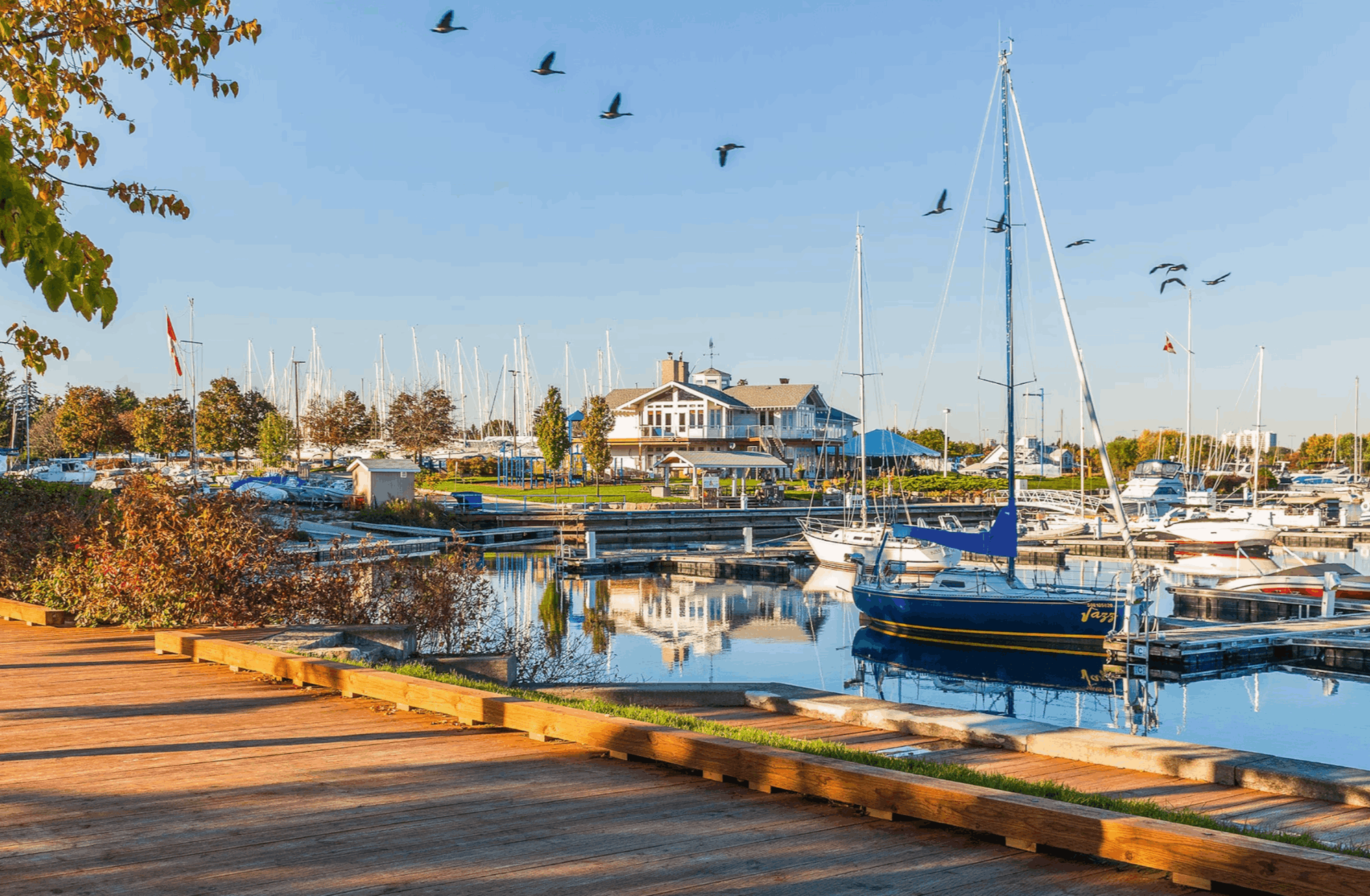
Mississauga, Ontario
Nine villages
that became a city.
Ontario's third-largest city, built from nine separate settlements along the lake and the Credit River. Here's what living here actually looks like.
A city assembled
from its villages.
Mississauga occupies 293 km² of Lake Ontario shoreline in Peel Region, west of Toronto and east of Oakville. The Credit River cuts diagonally through it to Port Credit, and defines much of the trail and park network.
Mississauga — 293 km² on the lake
0
Residents
(2021 Census)
0 km²
Land Area
0
Became a City
0
Median Age
Three GO Lines
Lakeshore West, Milton and Kitchener all run through the city — nine stations in total, plus MiWay and the Transitway BRT.
The Airport Is Local
Toronto Pearson sits inside Mississauga's northeast corner, which makes it a drive rather than a highway trip.
The Credit River
Runs the length of the city through Erindale Park and the Culham Trail, emptying at Port Credit harbour.
A Built Downtown
Square One opened in 1973 and is Ontario's largest shopping centre; Celebration Square and the City Centre condo district grew around it.
Two Village Main Streets
Port Credit's Lakeshore Road and Streetsville's Queen Street South both predate the city and still feel like towns.
The Hazel McCallion LRT
Running the Hurontario corridor, named for the mayor who ran the city for thirty-six years.
Population, area and median age from the 2021 Census of Population (Statistics Canada). The 2021 count was a 0.5% decline from 2016 — the first in the city's history. Statistics Canada estimated roughly 765,000 residents in 2025.
What People Love
Why people move here
and then stay.
Ask ten Mississauga residents why they chose it and you'll get roughly these six answers.
Twenty neighbourhoods,
and what each one is like.
Mississauga runs from lakefront villages to 2000s subdivision. Choose a neighbourhood to see the schools, parks, commute and housing mix that define it.
South · Lakefront village
A harbour with a main street
Where the Credit River meets the lake. A walkable main street, a marina, and new waterfront mid-rise going up around the older housing stock.
Schools
Riverside PS, Port Credit Secondary School
Parks & Green Space
J.C. Saddington Park, Memorial Park
Getting Around
Port Credit GO (Lakeshore West); QEW
Walkability
Very walkable
Housing
Older detached and semis with new waterfront mid-rise condos
Southwest · Lakefront
Mississauga's established address
Between Clarkson and Port Credit south of the QEW. Large detached homes on mature treed lots, with Rattray Marsh at the water.
Schools
Whiteoaks PS, Lorne Park Secondary School
Parks & Green Space
Jack Darling Memorial Park, Rattray Marsh Conservation Area
Getting Around
Clarkson GO; QEW
Walkability
Car-dependent
Housing
Large detached homes on mature treed lots
Southwest · Lakefront
A village, and a GO station
The city's southwestern corner at the Oakville border, with a small village core and one of the busiest GO stations on the Lakeshore West line.
Schools
Hillside Senior PS, Clarkson Secondary School
Parks & Green Space
Rattray Marsh, Bradley Museum grounds
Getting Around
Clarkson GO; QEW
Walkability
Somewhat walkable
Housing
Detached, semis and townhouses of mixed vintage
South · Credit River
Ravine lots, custom builds
Between Port Credit and the QEW on both sides of the Credit. Large custom homes, many backing onto ravine, on some of the city's deepest lots.
Schools
Kenollie PS, Port Credit Secondary School
Parks & Green Space
Kenollie Park, Credit River valley trails
Getting Around
Port Credit GO; QEW at Hurontario
Walkability
Car-dependent
Housing
Large custom detached homes, many on ravine lots
Southeast · Lakefront
The eastern lakeshore, rebuilding
Mississauga's southeastern corner at the Toronto border. Post-war bungalows being steadily replaced by infill, with the waterfront redevelopment alongside.
Schools
Allan A. Martin Senior PS, Cawthra Park Secondary School
Parks & Green Space
Lakefront Promenade Park, Douglas Kennedy Park
Getting Around
Long Branch GO; QEW
Walkability
Somewhat walkable
Housing
Post-war bungalows with heavy new infill
Central · Hurontario
The old crossroads
One of the original nine villages, at Hurontario and Dundas. High-rise rental beside older detached streets, with the LRT now running through it.
Schools
Camilla Road Senior PS, T.L. Kennedy Secondary School
Parks & Green Space
Cooksville Park, Huron Park
Getting Around
Cooksville GO; Hazel McCallion LRT; Hwy 403
Walkability
Somewhat walkable
Housing
High-rise rental apartments alongside older detached homes
Central · Downtown core
A downtown built from scratch
Around Square One and Celebration Square. Almost entirely condo towers, with the transit terminal, the library and Sheridan's campus at the centre.
Schools
Hazel McCallion Senior PS, Father Michael Goetz Secondary School
Parks & Green Space
Kariya Park, Celebration Square
Getting Around
Square One bus terminal; Hazel McCallion LRT; Hwy 403
Walkability
Very walkable
Housing
Almost entirely condo towers
Central · Cooksville Creek
Central and affordable
Between the City Centre and Cooksville, following the creek. Townhouses and apartments with older detached mixed in.
Schools
Queenston Drive PS, T.L. Kennedy Secondary School
Parks & Green Space
Mississauga Valley Park
Getting Around
Hurontario LRT; Hwy 403
Walkability
Somewhat walkable
Housing
Townhouses, apartments and older detached
Central-west · Credit River
The river and the university
On the Credit around Dundas Street, with Erindale Park and the U of T Mississauga campus. Mature detached homes near the valley.
Schools
Springfield PS, Erindale Secondary School
Parks & Green Space
Erindale Park, Culham Trail
Getting Around
Erindale GO (Milton line); Dundas St and Hwy 403
Walkability
Car-dependent
Housing
Mature detached homes and bungalows near the river valley
West · Credit River village
A village that kept its main street
On the Credit north of the 403, with Queen Street South running as a proper village main street and the Bread and Honey Festival each June.
Schools
Vista Heights PS, Streetsville Secondary School
Parks & Green Space
Streetsville Memorial Park, Credit River trail
Getting Around
Streetsville GO; Hwy 401 and 403
Walkability
Very walkable along the main street
Housing
Older detached village homes with newer infill
West · Credit corridor
Planned in the 1970s
A large planned community west of the Credit, built on curvilinear streets with trails threaded between them.
Schools
Middlebury PS, John Fraser Secondary School
Parks & Green Space
Sawmill Valley Trail, Erin Meadows Park
Getting Around
Erindale GO; Hwy 403
Walkability
Car-dependent
Housing
Detached homes and townhouses on curvilinear 1970s-80s streets
West · Town centre
Schools, and a town centre
Around Erin Mills Town Centre, with two of the city's most sought-after secondary schools and a mix of detached, townhouse and condo.
Schools
John Fraser Secondary School, St. Aloysius Gonzaga Secondary School
Parks & Green Space
Erin Meadows Park, Sugar Maple Woods
Getting Around
Erin Mills Town Centre transit hub; Hwy 403
Walkability
Somewhat walkable
Housing
Detached, townhouses and condo towers
West · Newer suburb
Built this century
Mississauga's western edge, built out through the 2000s. Detached and freehold townhouses around a large community common.
Schools
Oscar Peterson Public School, Stephen Lewis Secondary School
Parks & Green Space
Churchill Meadows Community Common
Getting Around
MiWay; Hwy 403 and 407
Walkability
Car-dependent
Housing
2000s detached and freehold townhouses
West · Sheridan Creek
Backing onto green corridors
West Mississauga above Clarkson, built in the 1970s with a lot of the housing backing onto creek and woodlot.
Schools
Green Glade Senior PS, Clarkson Secondary School
Parks & Green Space
Sheridan Park woodlot, Turtle Creek
Getting Around
Clarkson GO; QEW
Walkability
Car-dependent
Housing
1970s detached and townhouses backing onto green corridors
Northwest · Lake Wabukayne
A 1970s planned community
Northwest Mississauga around Lake Wabukayne, laid out as a planned community with its own town centre and a conservation area at the edge.
Schools
Plum Tree Park PS, Meadowvale Secondary School
Parks & Green Space
Lake Wabukayne Park, Meadowvale Conservation Area
Getting Around
Meadowvale GO (Milton line); Hwy 401 and 407
Walkability
Car-dependent
Housing
1970s detached and townhouses in a planned community layout
Northwest · Heritage
Ontario's first heritage district
The original 1836 hamlet, designated Ontario's first heritage conservation district. Century homes ringed by newer executive detached.
Schools
Settler's Green PS, Rick Hansen Secondary School
Parks & Green Space
Meadowvale Conservation Area, Second Line West heritage streets
Getting Around
Hwy 401 and 407; Meadowvale GO
Walkability
Car-dependent
Housing
19th-century heritage homes ringed by newer executive detached
North-central
1990s family subdivision
North-central Mississauga around Heartland, built through the 1990s. Detached and townhouses with big-box retail and the 401 close by.
Schools
David Leeder Middle School, Rick Hansen Secondary School
Parks & Green Space
Eastgate Park, Braeben trails
Getting Around
Hwy 401 and 403; Meadowvale GO
Walkability
Car-dependent
Housing
1990s detached and townhouses
East · Dixie
Mid-century, wide lots
East Mississauga around Dixie Road, built through the 1950s and 60s. Bungalows and side-splits on unusually wide lots.
Schools
Burnhamthorpe PS, Applewood Heights Secondary School
Parks & Green Space
Garnetwood Park, Applewood Hills Park
Getting Around
Dixie GO; Hwy 403 and 427
Walkability
Car-dependent
Housing
Mid-century bungalows and side-splits on wide lots
East-central · Burnhamthorpe
Central east, mixed housing
Between Applewood and the City Centre along Burnhamthorpe, with the Etobicoke Creek trail at its eastern edge.
Schools
Silver Creek PS, Philip Pocock Catholic Secondary School
Parks & Green Space
Rathwood Park, Etobicoke Creek Trail
Getting Around
Hwy 403 and 427; MiWay
Walkability
Car-dependent
Housing
Detached, semis and townhouses
Northeast · Airport
Where the airport started
Mississauga's northeast corner beside Pearson, on the land acquired for the airport in 1937. Detached, townhouses and apartment blocks.
Schools
Brandon Gate PS, Lincoln M. Alexander Secondary School
Parks & Green Space
Paul Coffey Park, Wildwood Park
Getting Around
Malton GO (Kitchener line); Hwy 427 and 407; Pearson minutes away
Walkability
Car-dependent
Housing
Detached, townhouses and apartment blocks
Neighbourhood boundaries vary between sources, and school catchments change — always confirm the catchment for a specific address with the relevant school board.
Fun Facts
Nine things you probably
didn't know about Mississauga.
A rifle factory, a rail disaster with no casualties, and a mayor who served thirty-six years.
The name derives from the Anishinaabe Misi-zaagiing — “those at the Great River-mouth.” Under Treaty 14 in 1805, officials purchased 85,000 acres from the Mississaugas of the Credit.
Clarkson, Cooksville, Dixie, Erindale, Lakeview, Lorne Park, Port Credit, Sheridan and Summerville were the original settlements of Toronto Township.
A November 1979 derailment of chlorine and propane tankers triggered the evacuation of around 200,000 people — the largest peacetime evacuation in North America at the time — with no deaths and no serious injuries.
Hazel McCallion served from 1978 to 2014, winning twelve consecutive elections and retiring at 93. She personally directed the 1979 evacuation in her first year in office.
The Malton airport lands were acquired in 1937. They became Toronto Pearson International, which still sits inside Mississauga's boundaries.
Small Arms Limited in Lakeview ran from 1941 to 1945, producing over 900,000 Lee-Enfield rifles. By 1943 it employed more than 5,300 workers, about 65% of them women.
Meadowvale Village, founded in 1836, was the first heritage conservation district designated in the province.
Absolute World Towers 1 and 2, completed in 2012, won the Emporis Skyscraper Award. The curved taller tower was nicknamed within days of the design's release.
The 2021 Census recorded 717,961 — a 0.5% decline from 2016 and the first drop in the city's recorded history. Peel forecasts still reach nearly a million by 2051.
Sources include the City of Mississauga, Heritage Mississauga, the Canadian Encyclopedia and Statistics Canada.
Homes in Toronto
See what's on the market
right now.
Every active listing across Toronto, updated as it comes to market. In a city this size the neighbourhood matters more than the search filter — start with a conversation.